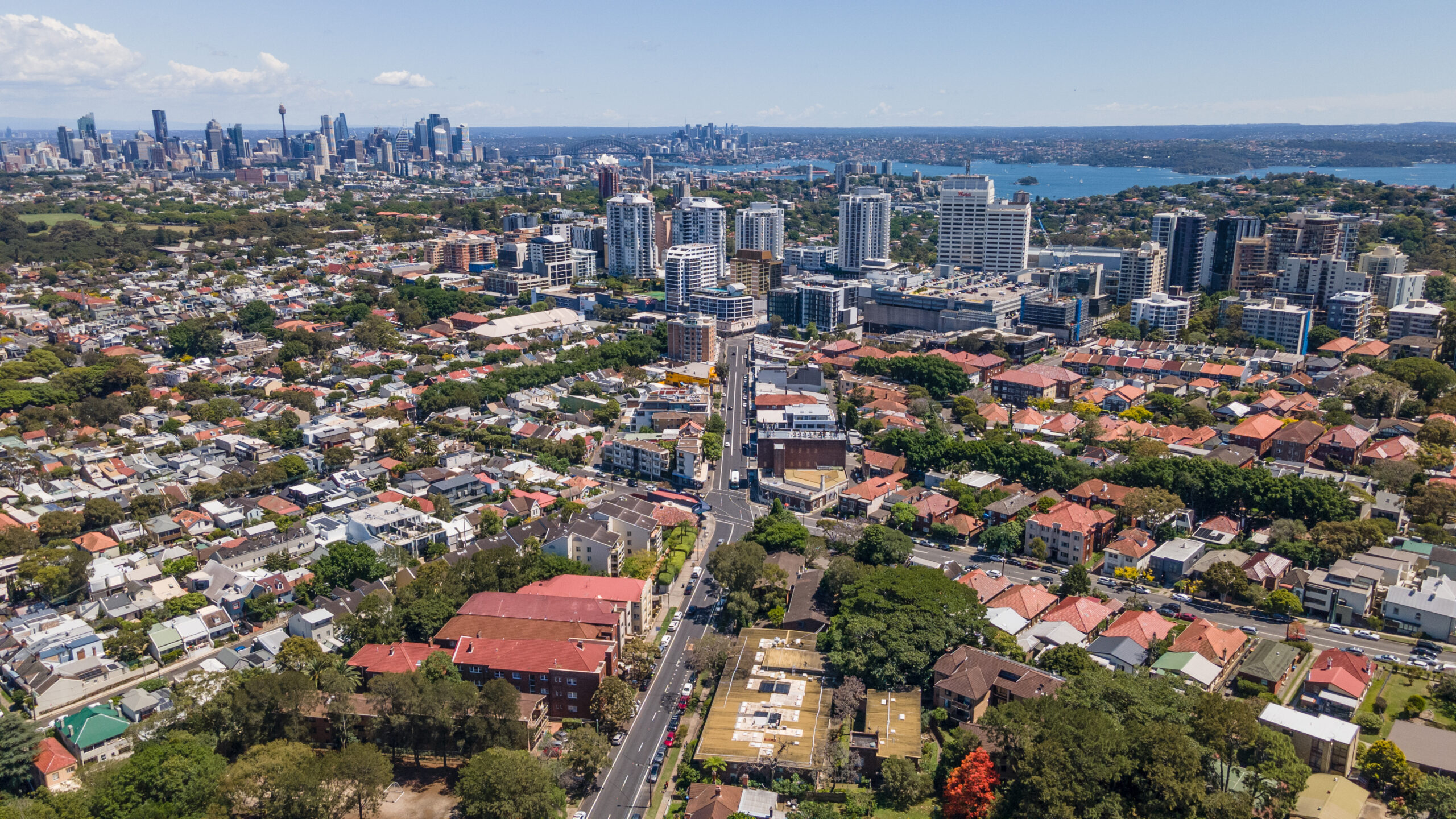
As population growth continues across the Central Coast and Greater Newcastle region, Wyee is emerging as one of the key locations for future housing delivery.
For property owners, this raises an important question – Can your land in Wyee be rezoned to unlock additional development potential?
Strategic planning documents released by the NSW Government and Lake Macquarie City Council identify the Greater Morisset growth area, including Wyee, as a location expected to accommodate significant new housing and community infrastructure over the coming decades.
For property owners, this raises an important question: Can your land in Wyee be rezoned to unlock additional development potential?
In many cases, land that is currently zoned for rural or low-intensity uses may have strategic potential for future residential development through a Planning Proposal (rezoning).
If you own land in Wyee, you’ve probably noticed the tone of local planning conversations shifting over the last few years.
More talk about housing, services, and “future growth”. More attention on Morisset and the broader corridor between the Central Coast and Newcastle.
For some landowners, that leads to a very practical question: Is my block ever going to move beyond RU4 — and if so, what would it take?
Rezoning can open up options, but it’s not a quick form or a simple tick-box exercise. A serious rezoning case needs two things to stack up:
- Strategic sense (does it fit where Wyee is meant to grow?), and
- Site sense (can the land actually support the kind of development being proposed?)
This article walks through both — without pretending every site has a pathway.
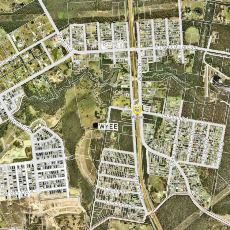
Why Wyee Is Becoming a Development Growth Area
Wyee is often discussed as part of the Greater Morisset growth area.
That matters because once an area is in the “future housing and infrastructure” conversation, land that used to be treated as semi-rural can start being assessed through a different lens — especially when it sits near transport, centres, or existing subdivisions.
State and council strategy documents point in a similar direction.
These include:
Hunter Regional Plan 2041
The Hunter Regional Plan identifies the Central Lakes District as a major growth corridor between the Central Coast and Newcastle.
The plan encourages:
- new housing close to transport
- diverse residential neighbourhoods
- community infrastructure that supports growing populations.
Lake Macquarie Local Strategic Planning Statement (LSPS)
The LSPS positions Wyee as an emerging Local Centre, expected to evolve from a rural village into a connected urban community with housing, services and transport infrastructure.
Wyee Structure Planning
Council investigations into the Wyee town centre indicate that parts of the locality may experience substantial population growth in coming decades, requiring additional housing and local services.
These planning directions create opportunities for landowners to explore rezoning options where land is strategically located.
The theme is consistent: more homes where infrastructure can support them, and a stronger local centre over time (rather than scattered growth that’s hard to service).
If you’re a landowner, the key takeaway isn’t “rezoning is coming”. It’s this: Wyee is on planning radars, and that’s usually the first ingredient for rezoning to even be considered.
Why Some Land Is Still Zoned Rural in Wyee
A lot of Wyee is zoned RU4 Primary Production Small Lots, which historically matched how the area was used: rural lifestyle blocks, low-intensity development, and subdivisions that don’t push roads, sewer, and community services too hard.
In day-to-day terms, RU4 often means:
- Larger minimum lot sizes (commonly around the 1-hectare mark),
- Fewer dwellings overall, and
- Fewer “supporting uses” that people expect as an area urbanises.
What changes the conversation is context. Once you have residential areas growing nearby — and a centre that’s expected to mature — some RU4 parcels start looking like logical “next steps” on a map.
What Rezoning Can Unlock (And What It Can’t)
Rezoning doesn’t magically turn land into an approved subdivision. What it can do is change what’s permissible and what’s realistic to pursue through a future DA.
Depending on where the land sits and what the planning controls allow, a rezoning may create scope for:
- Subdivisions that look more like the surrounding neighbourhood, rather than large rural lots
- A higher residential yield, because minimum lot sizes and permissible housing types may change
- Local services in the right spot (things like childcare, small shops, or community uses), especially if the land sits close to an emerging centre
But rezoning isn’t the finish line. Even after a successful rezoning, you still need the next stage (and the next set of technical checks) before anything is built.
Key Indicators That Your Land May Have Rezoning Potential
Not every RU4 property is a rezoning candidate. When a site does have a stronger planning story, it often shares a few traits.
Land tends to be more compelling when it’s:
- Close to existing residential subdivisions
- Near a rail station or major transport route
- Within reach of a town centre, school, or other “activity” area
- Adjacent to existing residential zoning
- Already sitting inside (or right next to) an area flagged for future growth investigations
Even then, the “best looking” sites on a map can fall over on constraints — which is why early technical review matters.
Common Planning Constraints That Must Be Considered
This is where rezoning gets real. A Planning Proposal needs to show the land is capable of supporting development in a way that’s safe, serviceable, and defensible.
The usual suspects include:
- Bushfire risk
- Flooding and overland flow
- Biodiversity impacts and vegetation clearing limits
- Water, sewer and road capacity (and the cost of upgrades)
- Geotechnical conditions (slope, stability, reactive soils)
- Aboriginal cultural heritage considerations
Constraints don’t automatically kill a proposal — but they can change what’s feasible, what it costs, and how long it takes. Sometimes the “answer” is not “no”, but “not yet, not like that, and not without major infrastructure.”
How Rezoning Works In NSW
Rezoning land generally occurs through a Planning Proposal process under the Environmental Planning and Assessment Act.
- Early Investigation
A planner tests the strategic case and flags the likely technical reports (and deal-breakers).
- Pre-Lodgement With Council
You’re basically checking: Is council open to this idea, and what would they need to see?
- Planning Proposal Drafting
This is the formal argument: why a zoning change is reasonable, and how impacts will be managed.
- Gateway Determination
The NSW Department of Planning decides whether the proposal can proceed and sets conditions.
- Public Exhibition
The community and agencies provide feedback. This can reshape a proposal more than people expect.
- Finalisation
If supported, the planning instrument is amended, and the zoning change is made.
Timelines vary, but 12–24 months is a common range — and longer if there are heavy constraints, infrastructure questions, or agency conditions that need more work.
Why Early Planning Advice Is Important
If you’re trying to make a sensible decision — hold, sell, partner, or progress — the first goal is clarity.
A good preliminary planning investigation usually answers questions like:
- Does the site align with the strategic direction for Wyee?
- If it did rezone, what kind of outcomes are actually plausible?
- Which constraints are manageable, and which ones are likely to bite?
- What studies would be required, in what order?
- What’s a realistic timeline for decisions — not just lodgement?
That’s often enough to stop people wasting money on reports that don’t match the likely pathway.
How Meliora Projects Can Help
Meliora Projects works with landowners and developers across NSW on strategic planning matters, including rezoning and development pathways in the Lake Macquarie region.
Our services include:
- Preliminary planning investigations
- Planning proposals and rezoning strategy
- Development approval advice (staging, pathways, risks)
- Social impact assessments
- Community and stakeholder engagement
If you own land in Wyee or the Lake Macquarie region, our team can help determine whether your property may have untapped development potential.
Don’t guess your land’s future — understand it.
Book a preliminary planning review to assess your site’s rezoning potential, constraints, and realistic pathways. Contact us today!
Frequently Asked Questions
Can RU4 Land Be Rezoned In Lake Macquarie?
Yes, it can be — in some locations. The stronger cases usually line up with strategic growth directions and can demonstrate that constraints (like bushfire risk, flooding, servicing and biodiversity) have workable solutions.
How Long Does Rezoning Take In NSW?
A Planning Proposal often takes around 12 to 24 months. Timeframes blow out when additional studies are needed, infrastructure upgrades are uncertain, or agencies require changes during exhibition.
What’s The First Step If I’m Considering Rezoning?
Start with a preliminary planning investigation. It’s the fastest way to understand whether the idea has strategic support and what evidence would be required to take it further.
How Can I Tell If My Land Might Have Development Potential?
Look for proximity to existing residential areas, rail/transport links, schools, town centres and land already being investigated for growth. A planner can then test the strategy and constraints to see whether rezoning is realistic.